The Laguna de Santa Rosa Wetland Complex
About • Ecology • History • More Information...
About The Laguna de Santa Rosa The Laguna de Santa Rosa is northern California's largest freshwater wetlands complex, situated in Sonoma County, known for its rich biological diversity. Its 22-mile channel is the primary tributary to the Russian River, draining a 254-square-mile watershed encompassing much of the Santa Rosa Plain, including Windsor, Santa Rosa, Rohnert Park, Cotati, Forestville, and Sebastopol. As a critical landscape feature, the Laguna plays a crucial role in Sonoma County's water quality and flood control. It serves as a natural reservoir during heavy rains, mitigating floods throughout the watershed and downstream along the Russian River.
Ecology of the Laguna de Santa Rosa The Laguna's Water Cycle The Laguna's Wildlife Spanning over 30,000 acres, the Laguna de Santa Rosa Wetland Complex is composed of seasonal and perennial freshwater wetlands such as creeks, ponds, marshes, vernal pools, swales, floodplains, riparian forest, and grassland, all located in the Laguna de Santa Rosa Watershed. It supports a wide array of wildlife including bald eagles, mink, bobcats, river otters, and numerous bird species. The wetlands of the Laguna are a vital stopover for migratory birds along the Pacific flyway. Its riparian forests, acting as a buffer between land and water, provide habitat, filter pollutants from runoff, and regulate water temperature for aquatic life. The complex includes an array of public and privately owned land with a variety of conservation status' that range from Wildlife Areas to Mitigation Banks. The area is considered a biological hotspot due to its various types of rare and unique wetlands like vernal pools and their associated rare and endemic plants such as Sonoma sunshine (Blennosperma bakeri) and animal species such as the California Tiger Salamander (Ambystoma californiense).
Besides its high biological value, the site provides flood control, scenic beauty, and recreation services to the majority of Sonoma County's human population.
The Laguna de Santa Rosa Complex main threats are associated to recent land use changes in the area such as wetland drainage for farming and expansion of urban areas, pollution due to excessive use of fertilizers in the Santa Rosa Plain, and hydrological changes due to the construction of drainage and flood control channels.
History of the Laguna de Santa Rosa Once, the Laguna de Santa Rosa was characterized by vast oak woodlands, dense riparian forests, lakes, and both perennial and seasonal freshwater wetlands. Native Americans hunted herds of elk and pronghorn antelope, while mountain lions and grizzly bears roamed the area. Tens of thousands of migratory birds depended on the Laguna's flooded waters in winter and its abundant food and shelter for breeding and nesting in summer.
A History of the Laguna de Santa Rosa
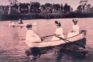
Image: Boating on what was once Lake Jonive in SebastopolNative Americans, Past to Present
Archaeological studies have established that Native Americans, including Pomo, Wappo and Miwok peoples, have lived in the Laguna watershed for more than 10,000 years. Nomadic seasonal gatherers, they thrived on acorns, roots, seeds, berries, fish, coastal shellfish, waterfowl, and a variety of game animals. They fashioned canoes, shelter, and rope from tule, wove fine, watertight baskets from willow and sedge, and harvested numerous other plants for food, clothing, dyes, and medicines.
Now established as the Federated Indians of Graton Rancheria, the current tribe consists of both Coast Miwok and Southern Pomo people.
Alterations to the Laguna
The first Mexican land grant in the Laguna was established in 1833, marking the beginning of ranching and farming in the area. Over the next century, significant changes transformed the Laguna. Early settlers cleared oak woodlands to cultivate grain, row crops, orchards, and hops. Hunters supplied San Francisco’s markets with wildlife; in 1892, a single hunter harvested 6,200 ducks. Resorts sprang up along the western edge of the Laguna, and lakes were drained.
Throughout the 1900s, agricultural activities intensified, alongside increased residential and commercial development in the upper watershed. Many miles of the Laguna were channelized for flood control, and riparian vegetation was extensively cleared. By 1990, 92% of the Laguna’s riparian forest had vanished, and the yellow-billed cuckoo, a bird dependent on riparian habitats, had disappeared from the area.
The Laguna de Santa Rosa Today
Where once swales and marshes formed and rainfall slowed and ponded in vernal pools throughout the valley, water now rushes in concentrated flow to the Laguna where it is joined by runoff from the western hills. Although the natural drainage system is now confined to the western third of the valley, it remains an impressive 22-mile-long waterway, with a floodplain of more than 7,500 acres.
The floodplain and adjacent uplands contain many distinctive natural features, including braided channels, pools, springs, seasonal and perennial wetlands, and riparian and oak woodland. In the summer these features are separate and distinct, but in the winter they can appear as one vast lake. The Laguna watershed comprises approximately ten percent of the entire Russian River drainage; and when the river floods, the Laguna can act as a huge natural reservoir, storing up to 80,000 acre-feet of water. For the residents of Guerneville, this can result in a 14-foot reduction in the height of the 100-year flood.
More Information...
- The Convention on Wetlands and Ramsar Designation – The Laguna Foundation spearheaded a coalition of private and public landowners in a lengthy effort to petition the Ramsar Convention to recognize the Laguna de Santa Rosa Wetland Complex. On February 2, 2011, World Wetlands Day, the Convention officially designated the Laguna de Santa Rosa Wetland Complex as a Wetland of International Importance.
- Recreation Along the Laguna – Explore the Laguna de Santa Rosa: Northern Californias largest freshwater wetlands, offering diverse habitats and year-round outdoor activities.
- Vernal Pool Story Map – Enjoy a visual journey and learn more about Vernal Pools on the Santa Rosa Plain by clicking through this engaging story map.
[ top ]
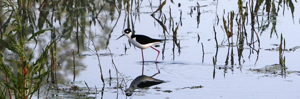
. Banner Image by Lucy Aaron